Turn Left at the Orange Roof: When America Navigated by Memory Instead of Maps

The Gas Station Oracle
In 1987, if you were driving from Chicago to Denver and got lost somewhere in Nebraska, your salvation came in the form of a middle-aged man in a grease-stained uniform standing behind the counter of a Sinclair station. This person wasn't just selling gas and motor oil—he was a keeper of local geography, a human GPS system who could guide you through the maze of American highways using nothing but landmarks, local knowledge, and hand gestures.
"You're gonna want to go about fifteen miles until you see the big red barn with the Mail Pouch tobacco sign," he'd tell you, drawing invisible maps in the air with his finger. "Turn left there, keep going until you hit the Howard Johnson's with the orange roof, then look for the Stuckey's billboard with the pecan log. Can't miss it."
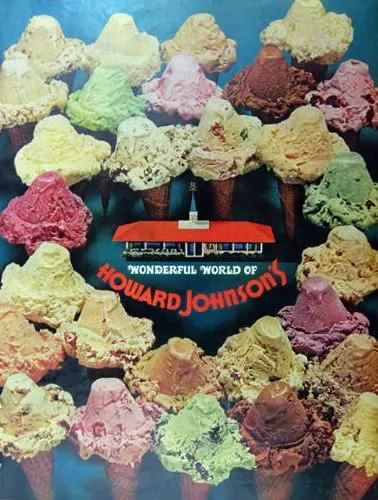 Photo: Howard Johnson's, via www.atticpaper.com
This wasn't just casual direction-giving—it was a sophisticated navigation system that millions of Americans relied on for cross-country travel. Before GPS satellites and turn-by-turn directions, the entire country was mapped not by coordinates, but by a collective memory of distinctive landmarks that served as waypoints for travelers.
The AAA Strip Map Era
The American Automobile Association understood that driving across the country required more than just road maps. Their famous "TripTik" strip maps, introduced in the 1960s, were hand-assembled route guides that highlighted specific landmarks, recommended gas stations, and noted important visual cues for navigation.
These weren't ordinary maps. AAA cartographers would drive routes personally, noting distinctive features that drivers could easily spot from their cars. The strip maps would highlight things like "large grain elevator on right side" or "distinctive red rock formation" or "Howard Johnson's restaurant with playground." Each TripTik was essentially a curated collection of navigation landmarks tailored to a specific route.
The genius of the system was that it worked with how people actually navigate. Humans don't think in terms of precise coordinates—we remember visual landmarks and spatial relationships. The AAA maps translated highway travel into a series of memorable waypoints that felt natural to follow.
The Howard Johnson's Navigation Network
By the 1970s, Howard Johnson's had become an unofficial navigation system for American highways. The restaurant chain's distinctive orange roofs and standardized architecture made them perfect landmarks for giving directions. "Turn right after the HoJo's" became as common as street addresses in American direction-giving.
The company had over 1,000 locations at its peak, strategically placed along major highways and designed to be visible from a distance. The bright orange roof wasn't just branding—it was functional navigation infrastructure. Travelers could spot a Howard Johnson's from miles away and use it as a reference point for finding their destination.
Other chains served similar functions. Holiday Inn's green signs, Stuckey's distinctive billboards, and Shell's yellow scallop logo became part of an informal but remarkably effective wayfinding system. These weren't just businesses—they were landmarks in America's collective navigation memory.
The Billboard Geography
Major highways were lined with billboards that served double duty as navigation aids. The famous "South of the Border" signs along I-95, advertising a Mexican-themed tourist stop in South Carolina, started appearing 200 miles north of the actual destination. These weren't just advertisements—they were mile markers that helped travelers gauge their progress and navigate to their destination.
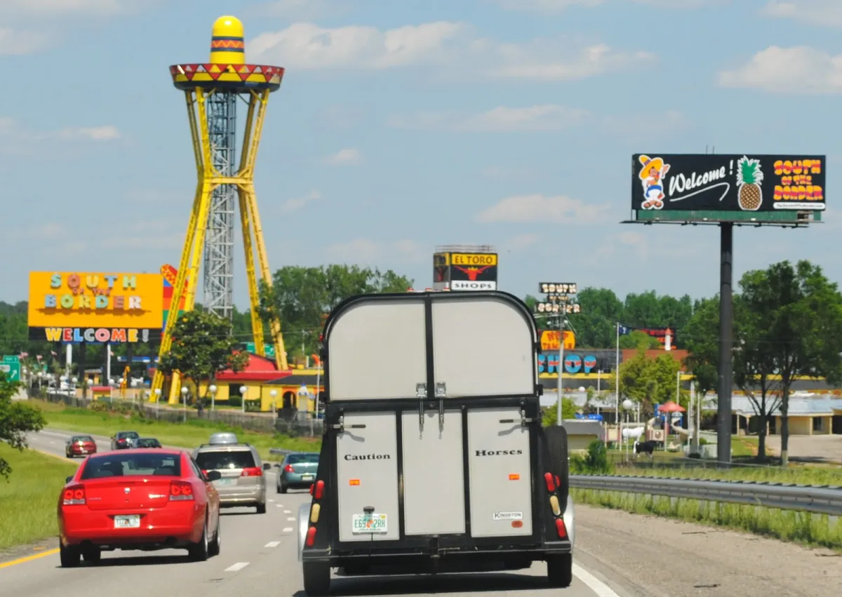 Photo: South of the Border, via 1.bp.blogspot.com
Stuckey's pecan billboards served a similar function across the South and Midwest. Travelers would use them as reference points: "We passed three Stuckey's signs, so we should be getting close to the exit." The billboards created a rhythm to highway travel, marking progress in a way that mile markers never could.
Even smaller businesses understood their role in this informal navigation network. Gas stations would advertise "Last Gas for 50 Miles" not just to attract customers, but to help travelers understand their location relative to the next services. Restaurants would put "Next Exit" on their signs to help drivers navigate the increasingly complex interstate system.
The Human Element of Navigation
What made this system work was the human knowledge that supplemented the physical landmarks. Gas station attendants, waitresses, and local residents served as living databases of road conditions, construction delays, and navigational shortcuts. They knew which routes were faster during different times of day, where speed traps were located, and how to avoid the worst traffic.
This created a social aspect to navigation that GPS has largely eliminated. Getting directions required talking to people, which often led to recommendations for good restaurants, interesting side trips, or warnings about road conditions ahead. Navigation was a social activity that connected travelers with local communities.
Truck drivers were the ultimate keepers of this knowledge. CB radio channels buzzed with real-time information about road conditions, police activity, and the best routes to avoid traffic. "Smokey report at mile marker 247" or "Construction backup eastbound at the big Texaco" became part of a continuous, collaborative navigation system that helped millions of travelers.
The Death of Landmark Navigation
The introduction of GPS technology in the 1990s and early 2000s fundamentally changed how Americans navigate. Suddenly, you didn't need to remember landmarks or ask for directions—a satellite system could guide you turn-by-turn to any address in the country.
But the shift to digital navigation had unintended consequences. As GPS became ubiquitous, the landmark-based navigation system began to collapse. Gas station attendants stopped learning local geography because customers stopped asking for directions. Distinctive roadside businesses lost their value as navigation aids and many closed or were replaced by generic chain stores.
The result was the erasure of an entire layer of American cultural geography. The Howard Johnson's orange roofs disappeared from highways. Distinctive local businesses were replaced by identical chain stores that looked the same whether you were in Ohio or Oregon. The visual landmarks that had helped define American road travel for decades simply vanished.
What We Lost Along the Way
The old landmark navigation system did more than just help people find their way—it created a shared cultural experience of American travel. Everyone knew what it meant to "look for the big water tower" or "turn at the Dairy Queen." These landmarks became part of the collective American memory, referenced in songs, movies, and family road trip stories.
GPS navigation is undeniably more efficient and accurate than the old system. You're less likely to get lost, and you don't have to rely on the knowledge and goodwill of strangers. But something was lost in the translation from landmark-based to coordinate-based navigation.
The old system required travelers to pay attention to their surroundings, to notice distinctive features of the landscape, and to engage with local communities. GPS allows you to drive across the country while barely noticing where you are, following a blue line on a screen instead of reading the landscape around you.
The Persistence of Memory
Interestingly, many Americans still think in terms of landmark navigation, even when using GPS. We'll tell friends to "meet us at the Starbucks near the big Target" rather than giving them an address. Local directions still reference prominent businesses, distinctive buildings, or geographical features that GPS can't adequately describe.
This suggests that landmark-based navigation taps into something fundamental about how humans process spatial information. We're wired to navigate by visual landmarks and spatial relationships, not by abstract coordinates. The old American navigation system worked because it aligned with our natural cognitive processes.
The Cultural Archaeology of American Roads
Today, you can still find remnants of America's landmark navigation system if you know where to look. Abandoned Howard Johnson's buildings, faded Stuckey's billboards, and closed gas stations with hand-painted signs serve as archaeological evidence of how Americans once found their way across the country.
These relics tell the story of a more social, more engaged way of traveling. They remind us that navigation was once a collaborative activity that connected travelers with local communities and required attention to the distinctive features of American landscapes.
The GPS revolution solved the problem of getting lost, but it also eliminated the adventure of finding your way. In replacing landmark navigation with satellite guidance, we gained efficiency but lost a uniquely American way of experiencing the country—one orange roof, one distinctive billboard, and one helpful gas station attendant at a time.